Monitoring Country
2 Ha Plot: Tracks, Scats, Diggings & Signs Survey
2 Ha Plot: Tracks, Scats, Diggings & Signs Survey
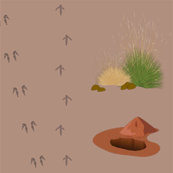
This is a method where trackers search a 2 hectare (Ha) area for all signs of animals, including tracks, scats, diggings and other signs. Signs can include:
· tracks
· fur or feathers
· scats
· dead animal
· diggings
· live animal
· burrows
If signs of an animal are found in a plot, data is recorded for its presence.

Tracks of (clockwise from top left) echidna, bird, goanna, bilby and hopping mouse. Credit: Mark Cowan
Why are 2 Ha Plots useful?
Less stress for animals: 2 Ha Plot surveys don’t involve catching and handling animals. Animals are often stressed if they are caught and handled by people.
Monitor all species: You can use tracking skills and collect data on all species that live on Country.
Inexpensive: 2 Ha Plot surveys don’t need highly specialised or expensive equipment.
Quick and flexible: 2 Ha Plot surveys don’t require much effort and can be done quickly and opportunistically when the weather conditions are suitable.
What can 2 Ha Plots monitor?
2 Ha plot survey is a good tool to monitor every animal that will leave a sign you can see.
This survey can be used to target things you are interested in, such as:
- Threatened species e.g. bilby
- Introduced animals e.g. cat
- Bush meat e.g. kangaroo

Ranger holding Bilby scat. Credit: Mark Cowan
What can you learn?
You can learn which species live (or don’t live) in a place, and which habitats they use the most. If you monitor the same places, over many years, you can see if there are changes to the species that live in a place. The data can also add to big picture understanding of species.
You can look at the changes over time and decide if your management, such as right way fire or cat control, is doing what you want it to do. Or it can tell you if you need to make adjustments.
You can do an occupancy analysis with your survey data.
What can’t you learn?
You can’t measure the number of animals living in a place (such as abundance or density).
You can’t monitor species that don’t leave any tracks, scats or signs.
Using 2 Ha Plots the Right-way
REMEMBER! Any time you do work that might disturb or interfere with native animals and vegetation, particularly threatened species, you need to check with the state authorities to see if you need any approvals, such as scientific licences or animal ethics committee permits.
- Monitor 2 Ha Plots in sunny weather because it is easier to see tracks. Early morning is better.
- Avoid windy weather because it will blow away signs.
- Make sure you check which species might be found in your area and check what signs they might leave. Make sure Rangers are trained to recognise the signs and take clear photos if they are not sure. Reference guides with photos of species scats tracks and signs are useful to take out on Country.
- By using these standardised methods, you can choose to share your data with the ‘Arid Zone Monitoring’ project. This program gather’s data and uses it to map the distributions of desert species and look for trends in abundance over time. Ultimately, the project’s aim was to create national-scale monitoring for desert wildlife and showcase the work being done in the deserts, especially by Indigenous ranger groups. Contact Sarah Legge at AridZoneMonitoring@gmail.com if you are interested in sharing data.
You can learn more about using the 2 Ha Plot in the 2 Ha Plot Tracks Scats Diggings and Signs Environmental Monitoring Method.
Primary sources
This landing page was developed using the following sources:
Primary sources
This landing page was developing using the following sources:
· NESP Threatened Species Recovery Hub. (n.d.). Data collection in track-based surveys. Retrieved June 13, 2024, from https://www.nespthreatenedspecies.edu.au/media/15cjoilx/azm-data-recording-sheet-and-instructions.pdf
· MONITORING DESIGN for track-based surveys, Arid Zone Monitoring Project
· Designing a track-based monitoring program to detect changes in species occupancy in the deserts of South Australia, Arid Zone Monitoring Project
· What data to collect during track-based surveys? Combining expert experience to develop a data collection template, Arid Zone Monitoring Project
· Arid Zone Monitoring Project website: https://aridzonemonitoring.org.au/
Tools and resources
Reference books that may be useful:
· Triggs, B. (1996). Tracks, scats and other traces: a field guide to Australian mammals.